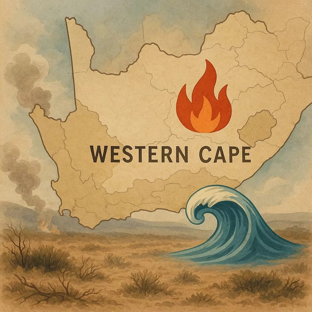
The Western Cape is getting ready for summer 2025/26 with a big plan to keep everyone safe. They’re watching out for fires, water accidents, and big crowds. This means using special planes for fires, working together with different groups, and telling people about dangers early. Their goal is to stop problems before they start, protecting nature, money, and most importantly, people’s lives.
What is the Western Cape’s 2025/26 Summer Readiness Initiative?
The Western Cape’s 2025/26 Summer Readiness Initiative is a comprehensive plan to mitigate risks from fires, water incidents, and crowds during the summer. It involves strategic deployment of aerial resources, inter-agency cooperation, early warning systems, and community engagement to ensure safety and minimize environmental and economic damage.
A province-wide blueprint for living safely with fire, water and crowds
1. The seasonal stakes
The Western Cape is South Africa’s fire-and-water paradox: one of the planet’s richest biodiversity hotspots wrapped around a coastline that attracts up to 600 000 extra bodies every December. Fynbos, the province’s signature vegetation, is designed to burn – every 10–15 years on average – yet 72 % of all wildfires now start within 200 m of a road, railway or settlement. Add an El-Niño-modulated rainfall deficit, three consecutive years of above-average growth and a visitor influx equal to the population of Iceland, and the result is a summer ripe for catastrophe. The 2025/26 Summer Readiness Initiative is the provincial government’s answer: a living document that moves money, machinery and messaging into position before the first smoke column or rip current forms.
The province contracts four fixed-wing Air Tractor 802F “Fireboss” scoopers (3 000-litre capacity, 140 km/h cruise) and two AS-350B3 “Squirrel” helicopters with 1 200-litre Bambi buckets. Activation trigger is a 30-minute readiness window from call to take-off; target containment is 90 % of fires under 30 ha within two hours. Each scooping run on the Breede River can deliver 18 000 L/hour at a variable cost of R11 per litre dropped – cheaper than the R18/L fixed-tanker rate and 4× faster than ground crews on mountain slopes. Aircraft are positioned at three forward bases:
– Cape Town International (AT802F pair) – coverage radius 120 km
– George Regional (single AT802F) – Garden Route primary response
– Worcester Airfield (rotary wing detachment) – Winelands/Overberg rapid reaction
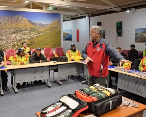
The Western Cape Fire & Emergency Services Mutual Aid Agreement now binds 26 municipalities, 3 district disaster-management centres, CapeNature, SANParks, Working on Fire and 14 volunteer wildfire-services. A shared 24/7 digital dispatch platform (Ionize CAD) rolled out in October 2025 pools 1 048 qualified wildland firefighters, 167 slip-on units, 18 Type-6/7 water tenders and 12 bulldozers. Standard strike-team configuration is five vehicles and 20 personnel able to self-sustain 36 hours in remote terrain. Strike-team leaders are “red-carded” under the US-inspired NWCG system to ensure interoperability when 40 km/h Santa Ana-style winds drive fires across municipal borders.
2. Weather outlook – why “slightly warmer than normal” is a code-red phrase
South African Weather Service seasonal models (issued July 2025) show a 65 % probability of above-median temperatures and a 55 % probability of below-median rainfall for the Western Cape. The key metric is not absolute drought but the number of consecutive “fire-danger days” (temperature > 30 °C, relative humidity < 20 %, wind > 30 km/h). Modelling by the Stellenbosch-based Climate System Analysis Group projects 18–22 such days between November and February, compared with a 1990–2020 average of 14. Each extra day translates, on average, into a 7 % rise in final burnt area once ignition occurs.
CapeNature’s veld-condition assessments (May–June 2025) sampled 420 plots across ten biomes. Mean fuel load is 3.8 t/ha – 38 % above the historical baseline – driven by two wet winters (2022–24) and invasive alien vegetation now occupying 12 % of the 6.2 million ha provincial surface. Port Jackson (Acacia saligna) alone adds an estimated 0.9 t/ha of fine fuels that burn 40 % hotter than native fynbos. The highest risk nodes are:
– Garden Route coastal plateau (continuous ladder fuels from plantation edges)
– Cape Winelands mountain catchments (dense pine and wattle regrowth after 2022–23 floods)
– West Coast grain belt (unharvested stubble and renosterveld fragments)
Provincial fire-history analysis (2015–24) shows lightning accounts for only 6 % of ignitions; the rest are human-related. Top culprits:
– Arson (31 %) – peaks during municipal-service protests and school holidays
– Equipment use (18 %) – angle-grinders, lawnmowers, power-line faults
– Agricultural activities (15 %) – harvesting burns that escape in afternoon winds
– Recreation (11 %) – campfires, fireworks, discarded cigarette butts
Behaviour-change campaigns therefore focus on time-of-day nudges: radio spots at 10:00 reminding contractors to stop welding at midday; WhatsApp stickers pushed to 1.1 million users every Friday afternoon; beach PA systems that play a 15-second “only you can prevent braai fires” jingle every 30 minutes.
3. Prevention pillars – prescribed fire, machines and communities
CapeNature will burn 28 500 ha under prescription before mid-December – its largest pre-season programme on record. Burns are scheduled for 28 blocks between 8 and 25 years post-fire, targeting 30 % mean fire-return intervals to keep fynbos diversity high and fuel loads below 2 t/ha. Burns are co-located with strategic wildfire simulation (FlamMap) corridors so that, should a wildfire start, it encounters low-fuel “black zones” within 500 m. Private landowners qualify for a 40 % rebate on annual rates if they complete certified ecological burns; 312 farmers have already enrolled, adding another 19 000 ha.
Invasive alien vegetation clearing is turbo-charged by two external income streams:
– Landowner associations bid for carbon-credit finance via the voluntary fynbos-restoration protocol (Verra ID 2774); 1.2 million tonnes CO₂-e worth R120 million are under validation.
– The Department of Forestry’s Natural Resource Management programmes pay teams R3 400 per hectare cleared, creating 2 400 seasonal jobs – half of them women – between Clanwillilian cedar stands and Haarlem pine thickets.
The award-free “BurnFire” app (60 000 downloads) allows anyone to geo-tag smoke columns; machine-learning triage sends high-confidence reports straight to dispatch, cutting false-call rate from 38 % to 11 %.
Water: NSRI’s “SafeTrx” app logs self-guided paddles and hikes; if a user fails to close a trip within the declared window, an SMS escalates to controllers who can home in on the last GPS ping to within 3 m.
4. Water-safety parallel track – drowning is a quieter disaster
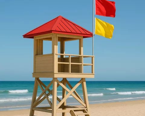
Last season the NSRI launched 967 missions, rescued 1 147 people and recovered 93 bodies – an all-time high. The 2025/06 grant of R408 000 to NSRI and Lifesaving Western Cape is tiny in budget terms but strategic: it funds 14 “pink buoy” stations at unpatrolled tidal pools, 38 rescuer kit upgrades (rescue tubes, spinal boards) and 24 drone-sortie hours for shark-bite mitigation at Plettenberg Bay and Fish Hoek. Drones also drop auto-inflating throw-bags within 90 seconds to swimmers 300 m offshore, cutting rescue time by 55 %.
Twelve Blue Flag beaches now run AI-enabled cameras that feed crowd-density algorithms to lifeguards’ smartwatches. When density exceeds 1 person/m² a silent haptic alert prompts proactive zone-splitting; at 1.4 /m² the municipal control room automatically deploys a second rescue craft. Beta-testing at Clifton 4th reduced minor bather incidents by 27 % without increasing lifeguard staff.
Farm dams account for 62 % of Western Cape drownings yet receive 5 % of media attention. The initiative funds 30 km of “peace-pods” – floating jetties with life-rings – on the Breede and Berg rivers. Signboards list water temperature (cold shock risk at < 15 °C) and real-time flow velocity from GaugingWeir API feeds; QR codes link to a 90-second video on safe river entry in Afrikaans, isiXhosa and English.
5. Resilience economics and future science
A 2024 Stellenbosch University study calculated the avoided-cost value of keeping one hectare of fynbos unburnt at R62 000:
– Water-provision services (protea-covered mountains absorb 30 % more rainfall than burnt slopes) = R28 000
– Tourism visibility (clear skies over Table Mountain National Park) = R19 000
– Carbon storage (4.2 t CO₂/ha) = R10 000
– Biodiversity (fewer extinctions of endemic plant species) = R5 000
Multiply the 75 000 ha burnt last season and the provincial economy dodged a R4.6 billion bullet – justifying the entire readiness budget (R66 million) by a factor of 70.
Night-time aerial ignition: The US Forest Service has proven that dropping delayed-ignition ping-pong balls after sunset creates counter-fire lines with 40 % less crew exposure. CapeNature will trial the tactic on two remote Outeniqua blocks in March 2026.
Pyro-economics of drones: Fixed-wing UAVs carrying 80 L of retardant can fly 4 h missions at 200 m AGL, saturating 50 ha/h at one-tenth the cost of a helicopter. A consortium of UCT and French CIRAD will deploy three test units over the Cederberg.
DNA bar-coding of smoke: Researchers can now identify which vegetation type is burning within 30 minutes by capturing airborne plant DNA on quartz filters mounted to helicopters. The system is being beta-tested to warn downwind communities of potential respiratory hazards.
The Global Wildland Fire Index (GWFI) ranks 195 regions on readiness, response and recovery. In 2024 the Western Cape scored 78/100 – tied with Victoria, Australia and Andalucía, Spain – ahead of California (74) and the Mediterranean average (71). Weakness: private-land fuel compliance (score 5.2/10). Strength: inter-agency coordination (9.3/10). Target for 2026: breach 80 overall, the threshold for “climate-resilient firescape” designation issued by UN-FAO and the International Association of Wildland Fire.
6. Calendar snapshot – what happens next
- 15 Nov: First aerial resources on standby, 30-minute rule activated
- 1 Dec: Prescribed-burn window closes; invasive-clear teams pivot to fire-break maintenance
- 15 Dec – 15 Jan: Joint operations centre (JOC) in Tygerberg runs 24/7 with 40-seat situational-awareness wall
- 7 Jan 2026: Mid-season review; if > 60 000 ha burnt, trigger contingency call for two additional Canadian Coulson C-130H airtankers
- 30 Apr 2026: Season close-out, data dump to open-source “FireMap SA” repository for researchers worldwide
The machinery is moving, the algorithms are humming, the buoys are in place. Somewhere between the cedar smell of a prescribed burn and the salt sting of an on-shore breeze, the Western Cape is rehearsing a summer that has not yet arrived – trying, hectare by hectare, wave by wave, to stay one spark or one rip ahead of disaster.
What is the Western Cape’s 2025/26 Summer Readiness Initiative?
The Western Cape’s 2025/26 Summer Readiness Initiative is a comprehensive plan designed to prepare the province for the 2025/26 summer season. Its primary goal is to enhance safety and mitigate risks associated with fires, water-related incidents, and large crowds. This is achieved through strategic deployment of resources like specialized aircraft for firefighting, fostering cooperation among various agencies, implementing early warning systems, and engaging with communities to prevent problems before they escalate. The overarching aim is to protect natural environments, economic assets, and most importantly, human lives.
What are the primary risks the initiative addresses?
The initiative primarily addresses three major risks: wildfires, water-related accidents, and incidents arising from large crowd gatherings. The Western Cape is particularly susceptible to wildfires due to its unique fynbos vegetation, which is prone to burning, and human-related ignitions. Water safety is crucial along its popular coastline, especially with a significant influx of tourists. Managing large crowds is also a priority to prevent accidents and ensure public order during the peak season.
What aerial resources are deployed for firefighting?
For firefighting, the Western Cape employs four fixed-wing Air Tractor 802F “Fireboss” scoopers, each with a 3,000-litre capacity, and two AS-350B3 “Squirrel” helicopters equipped with 1,200-litre Bambi buckets. These aircraft are strategically positioned at three forward bases: Cape Town International, George Regional Airport, and Worcester Airfield, ensuring rapid response across the province. The activation trigger for these resources is a 30-minute readiness window from call to take-off.
How does the initiative promote inter-agency cooperation?
The initiative strengthens inter-agency cooperation through the Western Cape Fire & Emergency Services Mutual Aid Agreement. This agreement binds 26 municipalities, 3 district disaster-management centres, CapeNature, SANParks, Working on Fire, and 14 volunteer wildfire services. A shared 24/7 digital dispatch platform, Ionize CAD, further streamlines communication and coordination, pooling resources like qualified wildland firefighters, water tenders, and bulldozers to ensure effective response across municipal borders.
What is the weather outlook for the 2025/26 summer, and why is it a concern?
The South African Weather Service seasonal models for July 2025 project a 65% probability of above-median temperatures and a 55% probability of below-median rainfall for the Western Cape. This outlook is a significant concern because it indicates an increased likelihood of “fire-danger days” (where temperature > 30 °C, relative humidity < 20 %, and wind > 30 km/h). Projections suggest 18–22 such days between November and February, compared to a historical average of 14, with each extra day potentially leading to a 7% rise in the final burnt area.
How is the initiative addressing water safety and drowning risks?
To address water safety, the initiative funds 14 “pink buoy” stations at unpatrolled tidal pools and provides 38 rescuer kit upgrades. Drones are utilized for shark-bite mitigation and can drop auto-inflating throw-bags to swimmers, significantly reducing rescue times. AI-enabled cameras at Blue Flag beaches monitor crowd density, alerting lifeguards to potential overloading. Furthermore, the initiative is installing 30 km of “peace-pods” (floating jetties with life-rings) on the Breede and Berg rivers, alongside signboards providing critical information like water temperature and flow velocity, to prevent drownings in often-overlooked farm dams and rivers.