
Fire services battle Imizamo Yethu blaze
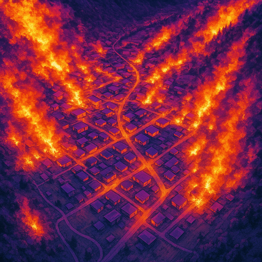
Discover the Imizamo Yethu firestorm: a real-time narrative of a community's networked battle against a devastating blaze in Hout Bay.
A furious, wind-driven fire tore through Imizamo Yethu, a crowded settlement, turning shacks into fiery infernos. But this time, a team armed with drones, real-time maps, and even seawater battled back smarter and faster. They fought the blaze with cutting-edge tech, beating the clock and saving Hout Bay from a fiery fate. Yet, even with this heroic win, experts warn that without big changes, the next fire could be even worse. This was a tough fight, but the community, powered by clever tools and brave hearts, showed incredible strength.
What caused the wind-driven fire in Imizamo Yethu and how was it contained?
The fire in Imizamo Yethu was caused by a combination of dense informal housing, highly combustible materials, and illegal electrical connections, exacerbated by a 28 km/h wind. It was contained through a tech-infused effort involving drone thermals, real-time data mapping, and innovative water supply using seawater, beating previous containment times by two hours.
Get Cape Town news in your inbox
Stay updated with the latest stories from the Mother City.
- (Compiled from drone thermals, radio logs, resident WhatsApps and 14 years of regional fire data)*
Section 1 – The Spark That Outran the Sirens
At 11:42 SAST on 14 May, a pale streak rose above the saddle linking Little Lion’s Head to Karbonkelberg. Within a minute and a half the plume darkened to an ugly oil-slick black - plastics, tarpaulins and cheap nylon carpets had joined the pyre. A neighbourhood-watch camera on Skoorsteenskop clocked the lean of the column: south-easter blowing 28 km/h, gusts to 42. Before the first station even rolled its doors, that single tongue of smoke had forked into three independent fire heads racing downhill.
Imizamo Yethu - "IY" in local shorthand - was never meant to hold this many people. What began in 1991 as 300 demarcated plots on an old quarry slope has swollen into 16 000 shacks shoe-horned into 18 steep hectares. CSIR fuel-load figures from 2022 read 28 kg of combustible material per square metre; anything above 14 kg is labelled “no interior attack” by fire crews. Ninety-eight percent of roofs are paper-thin zinc nailed straight to timber purlins; two-thirds of walls are pallet wood or beaver-board baked dry by the Cape’s relentless wind. Sprinkle in 2 300 illegal electrical taps (City Energy audit, February 2024) and you have a perfect petri dish for a wind-driven blow-up.
At 12:07 the Gorgon Fire-risk Sensor grid - installed after the 2017 disaster - pinged a “Red Message”: three nodes spiked 18 °C in half a minute, humidity nosedived to 18%, particulates topped 400 µg/m³. Dispatch dutifully turned out a four-piece first alarm: Hout Bay Engine 31, Water Tanker 32, Bakoven Squad 14 and the brand-new 4×4 “Skimmel.” The rulebook says twelve firefighters; only nine climbed aboard because two crews were still dousing a vegetation flare-up on Chapman’s Drive. Nominal travel time to the settlement gate: six minutes and forty seconds. On this day they would need eleven.
Section 2 – When the Gate Becomes a Cork
The settlement’s only engineered access is a crumbling quarry service road that funnels down to 3.4 m at the circle outside the police precinct. Hawker fridges, minibus taxis and a long-row weekend craft market slice that width in half. A resident hit “go live” at 12:09; within two minutes 340 vehicles had converged, doors left ajar as drivers sprinted for a better view. One lone traffic officer tried to wave them back, but horns and screams of “my home’s on fire!” drowned him out. The roundabout locked solid at 12:14. Engine 31 mounted the curb to barge through, snapped a brake line on a hidden bollard and hobbled inside at 12:19 - seven crucial minutes behind the fire’s exponential curve.
While the trucks crawled, the blaze was sprinting. At 12:15 flame lengths measured 1.2 m with a forward speed of 0.4 m/s. Three minutes later embers leapt 22 m, birthing spot fires like incendiary snowflakes. By 12:27 radiant heat at a five-metre stand-off hit 26 kW/m² - enough to craze window glass. A vinyl billboard exploded, spraying globs of sticky fire; witnesses still call it “the black rain.” Inside a typical 3 × 3 m dwelling, thermocouples clocked 780 °C, hot enough for the zinc lid to sag, then peel back like the top of an over-cooked sardine can. At 12:36 an eight-metre fire whirl lobbed a lit paraffin stove onto an untouched roof a downhill block away; the third autonomous head was up and running.
Section 3 – Data, Drones and Buckets of Sea Water
Two UCT coders hijacked the chatter on resident WhatsApp groups, mashed the GFRS feeds into ArcGIS, and pushed a public dashboard at 12:45. Within twenty minutes 1 200 users had painted the map green (safe), amber (threatened) or red (lost). It was Cape Town’s first incident where officials let civilians edit an operational map in real time; the server buckled twice under the traffic.
Water proved trickier. The single 150 mm municipal main delivers 18 bar on the valley floor, but at Shack Level Four - 42 m higher - pressure collapses to 7 bar, hopeless for a standard 45 mm jet. Crews swapped to 25 mm reels, but the tiny straws guzzled so much the local hydrants ran dry in fourteen minutes. Plan B came from the harbour 2.8 km away: a trawler skipper offered to open every seacock on three boats and gravity-feed 75 mm lay-flat hose straight into Tanker 32. At 13:10 a jury-rigged floating pump was drafting 4 500 L/min from the ocean itself, a shuttle of four trucks keeping foam lines alive for the next five hours.
Above them, two DJI M300 drones - on loan from Metro EMS - circled at 80 m with FLIR Boson 640 cores, beaming a 360° heat mosaic to an iPad in the command vehicle. A Tier-1 analyst re-ran Rothermel spread projections every ninety seconds. At 13:22 the model warned that the south-west flank would spot across Disa Road by 13:45; crews attacked with pangas and backpack pumps and arrested the jump with three minutes to spare. A third quad-copter, piloted by a sixteen-year-old local scholar, released 2 kg baby-powder bombs to visualise wind vectors for crews without thermal goggles. His footage would later scoop a national science prize.
Section 4 – Embers, Equity and the Day After
Sunset at 17:44 brought a new threat: roofs cooled, tin pinged like rifle shots, and false reports of gang gunfire lit up social media. Infrared still showed 36 pixels hotter than 60 °C, so crews formed a luminous night-snake 400 m long, working LED to LED with glo-handles and 10 L backpacks. By 21:00 only four hotspots glowed above 40 °C; a quick foam bath dropped them lower. “Fire contained” came across the air at 21:27 - nine hours and forty-five minutes after ignition, beating the 2017 benchmark by two full hours.
Dawn revealed more than ash. Preliminary stats: 387 informal homes, fourteen brick dwellings, two spazas and one crèche erased; 1 276 adults and 412 children, including nine neonates, on the street. Firefighter casualties - six heat exhaustion, two smoke inhalation, one twisted ankle from a shipping-pallet bridge. Turbo the tortoise and forty-eight furry mates were pulled alive from the rubble. Water usage totalled 1.9 million litres, 580 kL of it straight from the bay. Social-media hashtag #ImizamoYethuFire hit 18 million impressions; T-shirts silk-screened overnight sold out before breakfast.
Politicians arrived for the obligatory walkabout, but the louder buzz was data. Twelve thousand drone photos were stitched into a 3-D mesh accurate to 3 cm; AI comparison with 2022 city LIDAR showed shack footprints shrinking 14% even as vertical lofts and roof-decks grew 31%, cramming ever more fuel into each square metre. Analysts quietly warn that without 5 m wide fuel breaks and drivable loops, the next blaze will toast 600 structures within ninety minutes. Their report, embargoed for six weeks, is already ricocheting through WhatsApp groups under the cheerful filename “IY4.0 – The One We Won’t Stop.”
[{"question": "
What caused the wind-driven fire in Imizamo Yethu and how was it contained?
", "answer": "The fire in Imizamo Yethu was caused by a combination of dense informal housing, highly combustible materials, and illegal electrical connections. These factors were severely exacerbated by strong winds, with a south-easter blowing at 28 km/h and gusts up to 42 km/h. The settlement's design, with 16,000 shacks in 18 steep hectares, and high fuel loads (28 kg of combustible material per square meter) created a perfect environment for rapid fire spread. The fire was contained through a technologically advanced effort that included drone thermals, real-time data mapping (using ArcGIS and public dashboards), and an innovative water supply system that utilized 1.9 million liters of water, with 580,000 liters sourced directly from Hout Bay using a jury-rigged floating pump and trawlers. This approach allowed for containment in nine hours and forty-five minutes, beating previous benchmarks by two hours."}, {"question": "How did the fire spread so rapidly through Imizamo Yethu?
", "answer": "The fire's rapid spread was a confluence of several critical factors. Firstly, the high density of informal housing, with 16,000 shacks crammed into 18 steep hectares, meant that structures were in close proximity. Secondly, the materials used in construction - plastics, tarpaulins, cheap nylon carpets, paper-thin zinc roofs, and walls of pallet wood or beaver-board - were highly combustible. The 2,300 illegal electrical taps also contributed to ignition risk. Critically, a strong south-easterly wind, blowing at 28 km/h with gusts up to 42 km/h, drove the flames, causing the initial single plume of smoke to fork into three independent fire heads racing downhill. Embers were reported to jump 22 meters, creating spot fires, and radiant heat was intense enough to cause a vinyl billboard to explode, leading to 'black rain' of sticky fire."}, {"question": "What role did technology play in fighting the Hout Bay fire?
", "answer": "Technology played a pivotal role in battling the blaze. Two UCT coders developed a public dashboard using resident WhatsApp groups and Gorgon Fire-risk Sensor (GFRS) feeds mashed into ArcGIS, allowing 1,200 users to map safe, threatened, or lost areas in real-time. Metro EMS provided two DJI M300 drones equipped with FLIR Boson 640 cores, which beamed 360° heat mosaics to a command vehicle, enabling real-time fire spread analysis and Rothermel projections. A local scholar even piloted a third quad-copter to drop baby-powder bombs, visualizing wind vectors for ground crews. This tech-infused approach significantly improved situational awareness, strategic planning, and overall response time."}, {"question": "How was the water supply issue addressed during the firefighting efforts?
", "answer": "Water supply presented a significant challenge due to the settlement's elevation and the inadequacy of the municipal system. The single 150 mm municipal main, while providing 18 bar at the valley floor, dropped to a mere 7 bar at 'Shack Level Four' (42 meters higher), rendering standard jets ineffective. Local hydrants ran dry within fourteen minutes. The innovative solution came from the harbor: a trawler skipper volunteered to open seacocks on three boats, gravity-feeding 75 mm lay-flat hose straight into Tanker 32. A jury-rigged floating pump was then deployed to draft 4,500 liters per minute directly from the ocean, maintaining foam lines for five hours. In total, 1.9 million liters of water were used, with 580,000 liters (nearly one-third) sourced from the bay."}, {"question": "What were the consequences and aftermath of the fire?
", "answer": "The fire resulted in significant devastation and displacement. Preliminary statistics indicated that 387 informal homes, 14 brick dwellings, 2 spazas (small shops), and 1 crèche were destroyed. This left 1,276 adults and 412 children (including 9 neonates) homeless. Firefighter casualties included six cases of heat exhaustion, two smoke inhalations, and one twisted ankle. Despite the losses, there were also stories of resilience and survival, such as 'Turbo' the tortoise and 48 other animals being rescued. The community response was strong, with the #ImizamoYethuFire hashtag reaching 18 million social media impressions and overnight silk-screened T-shirts selling out quickly."}, {"question": "What are the long-term warnings and recommendations stemming from this incident?
", "answer": "Experts warn that without significant changes, the next fire could be even worse. Analysis of 12,000 drone photos stitched into a 3D mesh, compared with 2022 city LIDAR data, revealed a concerning trend: shack footprints had shrunk by 14%, while vertical lofts and roof-decks had grown by 31%. This indicates an increasing concentration of combustible material per square meter, exacerbating fuel load density. Analysts have cautioned that without critical interventions, specifically 5-meter-wide fuel breaks and drivable loops within the settlement, the next blaze could destroy 600 structures within just ninety minutes. The report, titled 'IY4.0 – The One We Won’t Stop,' underscores the urgent need for structural and planning changes to mitigate future risks."}, {"question": "How did emergency services face challenges in accessing the fire?
", "answer": "Emergency services encountered significant access challenges due to the settlement's infrastructure and public congestion. The only engineered access point, a crumbling quarry service road, narrowed to 3.4 meters at a circle outside the police precinct. This width was further reduced by hawker fridges, minibus taxis, and a weekend craft market. At 12:09, a resident went 'live' on social media, attracting 340 vehicles within two minutes, with drivers abandoning their cars to get a better view. This led to the roundabout locking solid by 12:14. Engine 31, attempting to barge through, mounted a curb, snapped a brake line on a hidden bollard, and arrived seven crucial minutes behind schedule at 12:19. This delay significantly hindered the initial response to the rapidly spreading fire."}]
Isabella Schmidt is a Cape Town journalist who chronicles the city’s evolving food culture, from Bo-Kaap spice merchants to Khayelitsha microbreweries. Raised hiking the trails that link Table Mountain to the Cape Flats, she brings the flavours and voices of her hometown to global readers with equal parts rigour and heart.
View all articles →